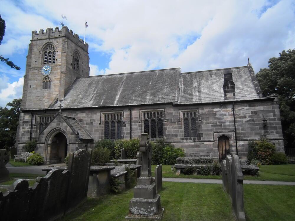
Hampsthwaite (St. Thomas a Beckett)
Harrogate • Station Ln, Hampsthwaite, Harrogate HG3 2HB • HG3 2HB
0
Burial records
25
Inscriptions / photos
0
YAS burials
0
YAS inscriptions
Location
- Also known as
- —
- Location
- Station Ln, Hampsthwaite, Harrogate HG3 2HB
- Postcode
- HG3 2HB
- Latitude / longitude
- 54.026711, -1.605454
Dates & affiliation
- Established year
- 0
- Year commenced
- —
- Year concluded
- —
- Denomination
- —
- Status
- Unknown
Resources
- Map
- —
- Website
- —
- Contact
- —
Availability
No burial records currently on site
Inscriptions / photos available
This summary shows material currently available on Yorkshire Burials.
Record Summary
- Burial records on Yorkshire Burials
- 0
- Inscriptions / photos
- 25
- Transcribed registers
- 0
- Other sources & resources
- 7
- YAS burials
- 0
- YAS inscriptions
- 0
- Cemetery map
- No
- Repositories noted
- Ancestry, North Yorkshire Archives Services, Website (Church)
Overview
The site also includes 25 inscriptions or photographs. Additional sources and supporting material have been identified in the Other Sources & Resources tab. Records or related material may be held by Ancestry, North Yorkshire Archives Services, Website (Church).
Nearby Cemeteries
Cemeteries within a selected radius of Hampsthwaite (St. Thomas a Beckett).
| Cemetery | Location | Distance |
|---|---|---|
| Burnt Yates (St Andrew's Church) | Admiral's Way, Burnt Yates, Harrogate HG3 3HG | 1.40 miles |
| Killinghall (St Thomas the Apostle Church) | 56-34 Otley Rd, Killinghall, Harrogate HG3 2DW | 1.63 miles |
| Ripley (All Saints) | — | 1.74 miles |
| Kettlesing (Felliscliffe Chapel of Ease) | — | 2.13 miles |
| Bishop Thornton (St Joseph) | Colber Ln, Bishop Thornton, Harrogate | 2.68 miles |
| Nidd (St Margaret and St Paul's Church) | — | 2.80 miles |
| Bishop Thornton (St John) | Bishop Thornton, Harrogate | 2.82 miles |
| Bilton (St John's Church) | Bilton Ln, Bilton, Harrogate HG1 3DT | 3.08 miles |
| Bilton (St John's Church) | Bilton Ln, Bilton, Harrogate HG1 3DT | 3.08 miles |
| Hartwith (St Jude's Church) | Harrogate HG3 3EZ | 3.15 miles |
| Bishop Thornton (Old Tower) | — | 3.24 miles |
| Harrogate (Grove Hill) | Grove Hill: Cemetery Lodge, Grove Road, Harrogate, HG1 5EW | 3.40 miles |
| Harrogate (Harlow Hill Cemetery) | Harlow Hill: Otley Road, Harrogate, HG2 0DA | 3.57 miles |
| South Stainley (The Parish Church of Saint Wilfrid) | South Stainley, Harrogate HG3 3NE | 3.90 miles |
| Harrogate (Christ Church) | Harrogate | 3.95 miles |
| Markington (St Michaels Church) | Westerns Ln, Markington, Harrogate HG3 3PB | 4.12 miles |
| Scotton (St Thomas's Church) | — | 4.13 miles |
| Brearton (St John the Baptist) | Low Moor Ln, Brearton, Harrogate HG3 3BZ | 4.16 miles |
| Scotton (Friends Burial Ground) | — | 4.17 miles |
| Dacre (United Reformed Churchyard) | Main Harrogate Road, Dacre, Summerbridge | 4.29 miles |
| Dacre Banks (Holy Trinity Church) | Church Hill House Vicarage, Harrogate | 4.32 miles |
| Dacre (Friends Burial Ground) | — | 4.60 miles |
Other Sources & Resources
This tab lists archive references, record locations, digitised copies, maps, histories, websites, and other material relating to this cemetery.
Burial Register
Notes
191 Images
Burial Register
Notes
200 Images
Burial Register
Notes
116 Images
Burial Ground Management System
Notes
Interactive Plan, Index and Photographs
Burial Register
Notes
Records available on microfilm [MIC 580].
Burial Register
Notes
Records available on microfilm [MIC 580].
Burial Register
Notes
Records available on microfilm [MIC 580].