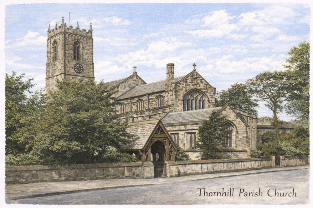
Thornhill (St Michael and All Angels Parish Church)
Kirklees • Church Ln, Thornhill, Dewsbury WF12 0JZ • WF12 0JZ
0
Burial records
7
Inscriptions / photos
0
YAS burials
0
YAS inscriptions
Location
- Also known as
- —
- Location
- Church Ln, Thornhill, Dewsbury WF12 0JZ
- Postcode
- WF12 0JZ
- Latitude / longitude
- 53.665412, -1.619254
Dates & affiliation
- Established year
- 0
- Year commenced
- —
- Year concluded
- —
- Denomination
- —
- Status
- Open
Resources
- Map
- —
- Website
- Link
- Contact
- —
Availability
No burial records currently on site
Inscriptions / photos available
This summary shows material currently available on Yorkshire Burials.
Record Summary
- Burial records on Yorkshire Burials
- 0
- Inscriptions / photos
- 7
- Transcribed registers
- 0
- Other sources & resources
- 1
- YAS burials
- 0
- YAS inscriptions
- 0
- Cemetery map
- No
- Repositories noted
- Yorkshire Archaeological & Historical Society, Family History Section
Overview
The site also includes 7 inscriptions or photographs. Additional sources and supporting material have been identified in the Other Sources & Resources tab. Records or related material may be held by Yorkshire Archaeological & Historical Society, Family History Section.
Nearby Cemeteries
Cemeteries within a selected radius of Thornhill (St Michael and All Angels Parish Church).
Other Sources & Resources
This tab lists archive references, record locations, digitised copies, maps, histories, websites, and other material relating to this cemetery.
Thornhill (St Michael and All Angels) Grave yard Map