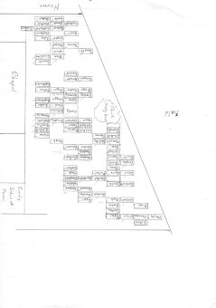
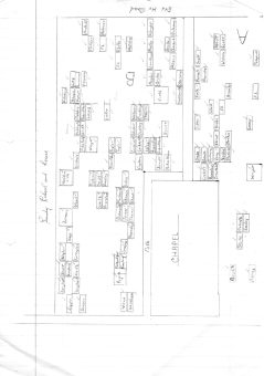
Queensbury (Ambler Thorn United Methodist Chapelyard)
Calderdale
0
Burial records
2
Inscriptions / photos
0
YAS burials
0
YAS inscriptions
Location
- Also known as
- —
- Location
- —
- Postcode
- —
- Latitude / longitude
- 53.760120, -1.859070
Dates & affiliation
- Established year
- —
- Year commenced
- —
- Year concluded
- —
- Denomination
- —
- Status
- Unknown
Resources
- Map
- —
- Website
- —
- Contact
- —
Availability
No burial records currently on site
Inscriptions / photos available
This summary shows material currently available on Yorkshire Burials.
Record Summary
- Burial records on Yorkshire Burials
- 0
- Inscriptions / photos
- 2
- Transcribed registers
- 0
- Other sources & resources
- 2
- YAS burials
- 0
- YAS inscriptions
- 0
- Cemetery map
- No
- Repositories noted
- Yorkshire Archaeological & Historical Society, Family History Section
Overview
The site also includes 2 inscriptions or photographs. Additional sources and supporting material have been identified in the Other Sources & Resources tab. Records or related material may be held by Yorkshire Archaeological & Historical Society, Family History Section.
Nearby Cemeteries
Cemeteries within a selected radius of Queensbury (Ambler Thorn United Methodist Chapelyard).
| Cemetery | Location | Distance |
|---|---|---|
| Ambler Thorn (Union Chapel) | Halifax Rd, Ambler Thorn, Queensbury, Bradford | 0.09 miles |
| Queensbury And Shelf (Queensbury) Cemetery | 9-29 Broomfield St, Queensbury, Bradford | 0.64 miles |
| Queensbury (Holy Trinity Church) | W End, Queensbury, Bradford BD13 2AD | 0.64 miles |
| Bradshaw (St John's Church) | — | 1.13 miles |
| Illingworth (Methodist Chapel) | — | 1.52 miles |
| Hipperholme (Mount Zion Methodist Chapel) | — | 1.61 miles |
| Illingworth (St Mary's Church) | — | 1.61 miles |
| Clayton Heights (Wesleyan Methodist Chapel) | — | 1.65 miles |
| Shelf (Wadehouse Primitive Methodist Chapel) | — | 1.88 miles |
| Shelf (Witchfield Wesleyan) | — | 1.98 miles |
| Ovenden, St Georges Church | — | 2.03 miles |
| Clayton Methodist Church | 19 Clayton Ln, Clayton, Bradford BD14 6PA | 2.07 miles |
| Shelf (Pollard Family Cemetery) | — | 2.13 miles |
| Thornton (Kipping Independant Chapel) | Market Street, Thornton, Bradford, BD13 3HP | 2.16 miles |
| Thornton (The Old Bell Chapel) | — | 2.22 miles |
| Clayton Bradford (St. John the Baptist) | 43 The Avenue, Clayton, Bradford | 2.24 miles |
| Thornton (St James' Church) | Thornton Rd, Thornton, Bradford BD13 3AB | 2.24 miles |
| Clayton, Bradford (Baptist Chapel Yard) | — | 2.27 miles |
| Shelf (St. Michaels & All Angels Church) | 80 Carr House Rd, Shelf, Halifax HX3 7RJ | 2.28 miles |
| Thornton, Cemetery | 697 Thornton Rd, Thornton, Bradford | 2.29 miles |
| Mount Pellon (Christ Church) | 5 Church Ln, Halifax HX2 0EF | 2.35 miles |
| Denholme Clough Primitive Methodist Burial Ground | Halifax Road, Denholme Clough, Bradford, | 2.39 miles |
| Coley (St John the Baptist) | Coley Rd, Hipperholme, Halifax HX3 7SA | 2.43 miles |
| Moor End, United Reform Chapel | — | 2.59 miles |
| Halifax (Lister Lane Cemetery) | 109 Lister Ln, Halifax | 2.64 miles |
| Halifax (Holy Trinity Church) | — | 2.79 miles |
| Mount Tabor Methodist Chapel | — | 2.83 miles |
| Clayton Cemetery | Middle Ln, Clayton, Bradford BD14 6DE | 2.87 miles |
| Denholme (St Pauls) | 229 Halifax Rd, Denholme, Bradford | 2.89 miles |
| Hipperholme (Mount Pleasant Chapel) | Bramley Lane | 2.94 miles |
| Southowram (Bank Top Methodist Chapelyard) | — | 2.97 miles |
| King Cross (St. Paul's Church) | Queen's Rd, Halifax HX1 3NU | 3.12 miles |
| Halifax (Stoney Royd Cemetery) | — | 3.19 miles |
| North Bierley, Cemetery | 27 Royds Hall Ln, Low Moor, Bradford | 3.26 miles |
| Scholemoor Cemetery & Crematorium | Necropolis Road, Bradford | 3.29 miles |
| Buttershaw (St Pauls Church) | — | 3.32 miles |
| Great Horton (Methodist Chapel Burial Ground) | Great Horton Road, Bradford | 3.38 miles |
| Halifax (King Cross Methodist Chapel) | — | 3.38 miles |
| Allerton (Methodist Church) | Greenbank Rd, Allerton, Bradford | 3.40 miles |
| Denholme (Wesleyan Methodist Burial Ground) | Keighley Road, Denholme | 3.41 miles |
| Allerton (Bradford) (Congregational Cemetery) | 345 Allerton Rd, Allerton, Bradford | 3.46 miles |
| Denholme (The Shared Church) | Keighley Rd, Denholme, Bradford | 3.51 miles |
| Low Moor (St. Marks Church) | 2 St Mark's Terrace, Low Moor, Bradford | 3.71 miles |
| Warley, Cemetery | — | 3.71 miles |
| Lightcliffe (St Matthew's Church) | — | 3.76 miles |
| Luddenden Cemetery | — | 3.77 miles |
| Southowram (St Anne In The Grove C Of E Church) | Church Ln, Southowram, Halifax HX3 9TD | 3.89 miles |
| Wyke (St. Mary the Virgin Church) | Green Ln, Wyke, Bradford | 3.94 miles |
| Wilsden (St Matthew's Churchyard) | Lane Side, Wilsden, Bradford | 3.94 miles |
| Bankfoot (St. Matthews Church) | Carr Btm Rd, Bradford BD5 9AA | 3.95 miles |
| Luddenden Dean Wesleyan Methodist Chapel | — | 3.98 miles |
| Warley (Butts Green Baptist Chapel) | — | 4.04 miles |
| Lower Wyke (Moravian Church) | Chapel Fold, Lower Wyke, Wyke, Bradford BD12 9AE | 4.08 miles |
| Bradford (Daisy Hill Primitive Methodist Chapel Chapelyard) | — | 4.11 miles |
| Halifax (All Saints Church) | — | 4.11 miles |
| Low Moor, Holy Trinity Church | Park House Rd, Low Moor, Bradford BD12 | 4.11 miles |
| Low Moor (Wesley Place Methodist) | — | 4.19 miles |
| Wyke (Westfield United Reform Church) | 162 Westfield Ln, Wyke, Bradford | 4.29 miles |
| Horkinstone Baptist Burial Ground | 97 Denholme Rd, Leeming, Oxenhope, Keighley | 4.32 miles |
| Wilsden Cemetery | Wilsden, Bradford | 4.33 miles |
| Sowerby Bridge, Cemetery | — | 4.37 miles |
| Copley (St Stephen's Church) | Greetland, Halifax HX4 8QB | 4.37 miles |
| Brighouse Cemetery | — | 4.39 miles |
| Norland (St Lukes Church) | — | 4.48 miles |
| Luddenden Foot Congregational Chapel | — | 4.49 miles |
| Sowerby (St. George) Churchyard | 2 Haugh End Ln, Sowerby Bridge HX6 3BJ | 4.52 miles |
| Lister Hills (Congregational Chapel Burial Ground) | Little Horton Road, Morley Street, Bradford | 4.67 miles |
| Elland Cemetery | — | 4.68 miles |
| Bradford (Toad Lane Presbyterian Chapel Chapelyard) | Toad Lane, Bradford | 4.81 miles |
| Heaton Graveyard | Highgate, Heaton, Bradford | 4.84 miles |
| Cullingworth Methodist Church | Dellside Fold, Cullingworth, Bradford | 4.91 miles |
| Sowerby (St. Peter's Church) | St Peter's Ave, Sowerby Bridge, Sowerby HX6 1HA | 4.92 miles |
| Oxenhope (Lowertown Old Burial Ground)(Wesleyan) | — | 4.95 miles |
| Greetland (St Thomas Church) | — | 4.97 miles |
| Bradford (Goodman's End Friends Burial Ground) | Wakefield Road, Croft Street | 4.99 miles |